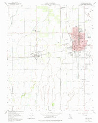
1954 Map of Hanford
USGS Topo · Published 1975About this map
Hanford serves as the central hub of this mid-century Central Valley landscape, its grid already established and expanding as a seat of local government and education. The city's social infrastructure is deeply mapped, featuring the Courthouse, City Hall, and a dense concentration of schools such as Washington Sch and Hanford Union High School. To the west, the settlements of Grangeville and Armona remain distinct communities, linked to the regional center by the Southern Pacific and Santa Fe railroads. The agricultural character of the valley is evident in the complex network of sloughs, including Mussel Slough and Lone Oak Slough, which cut through the orchard and field grids. Notable landmarks such as the County Fairgrounds, a Drive-in Theatre, and the Youd Sch (Aban'd) provide a detailed look at the local geography and the shifts in community development during this postwar era.
Find a feature on this map
47 named features on this map. Tap any name to fly to it.
Don’t see what you’re looking for? This feature index may not catch every label — zoom into the map to look around manually.
Map Details
Editions of this 1954 Hanford Map
2 editions found
Other maps of this area

1924 · Riverdale
USGS Topo · 1:31,680

1926 · Hanford
USGS Topo · 1:31,680

1926 · Burris Park
USGS Topo · 1:31,680

1927 · Laton
USGS Topo · 1:31,680

1927 · Remnoy
USGS Topo · 1:31,680

1927 · Riverdale
USGS Topo · 1:31,680

1927 · Lemoore
USGS Topo · 1:31,680

1928 · Waukena
USGS Topo · 1:31,680

1929 · Guernsey
USGS Topo · 1:31,680

1929 · Stratford
USGS Topo · 1:31,680