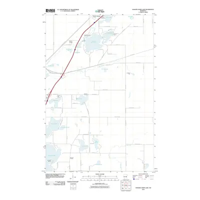
2010 Map of Hanging Horn Lake
USGS Topo · Published 2010About this map
Barnum occupies the northern edge of this Carlton County survey, where the Moose Horn River flows past the Riverside Cemetery. The landscape is defined by its deep glacial lakes and the legacy of rail transport, with the Soo Line Trl and the Willard Munger Trl tracing former railroad corridors across the terrain. These routes link a series of recreational camps and waterfronts, including Camp Wanakiwin on the shores of Hanging Horn Lake and the Moose Lake Camp further south.
Find a feature on this map
74 named features on this map. Tap any name to fly to it.
Don’t see what you’re looking for? This feature index may not catch every label — zoom into the map to look around manually.
Map Details
Editions of this 2010 Hanging Horn Lake Map
This is the sole edition of this map. No revisions or reprints were ever made.
Other maps of this area

1953 · Duluth
USGS Topo · 1:250,000

1954 · Atkinson
USGS Topo · 1:24,000

1956 · Barnum
USGS Topo · 1:62,500

1958 · Duluth
USGS Topo · 1:250,000

1961 · Cromwell
USGS Topo · 1:62,500

1961 · Moose Lake
USGS Topo · 1:62,500

1962 · Bruno
USGS Topo · 1:62,500

1980 · Sandstone
USGS Topo · 1:100,000

1980 · Duluth
USGS Topo · 1:100,000
1981 · Kerrick
USGS Topo · 1:24,000