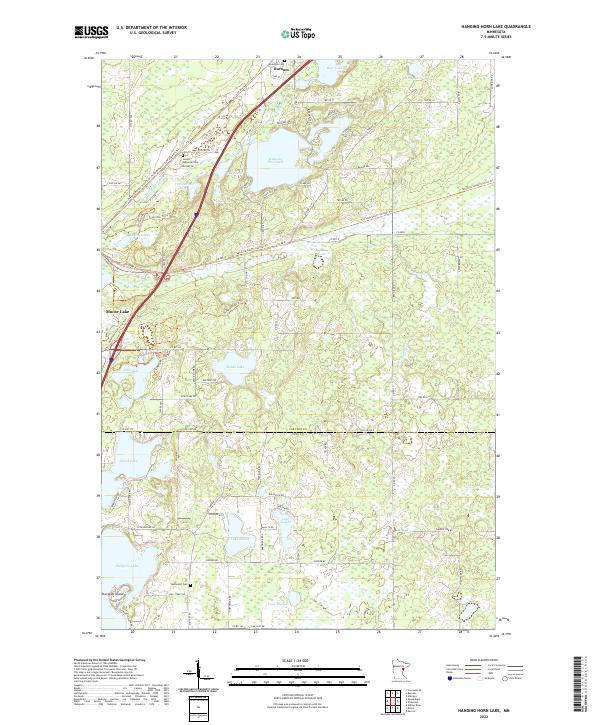
2022 Map of Hanging Horn Lake
USGS Topo · Published 2022About this map
The Moose Horn River winds through a landscape of glacial lakes and wetlands in this modern survey of the region between Barnum and Moose Lake. The area's transportation history is prominently marked by the conversion of former rail corridors into significant recreation routes, including the Willard Munger State Trail and the Soo Line South: Carlton Trl. These corridors follow the old grades that once fueled the timber and transport economy of Carlton County. Local history and genealogy are anchored by several notable sites, such as the Riverside Cem near the riverbanks and the Sunset Memorial Cem situated west of Hanging Horn Lake. Further south, the map details the boundary between Carlton and Pine Counties, passing through dense lake country including Lake Twelve and Sturgeon Lake, where the Methodist Cem serves as a landmark for early local settlement.
Find a feature on this map
96 named features on this map. Tap any name to fly to it.
Don’t see what you’re looking for? This feature index may not catch every label — zoom into the map to look around manually.
Map Details
Editions of this 2022 Hanging Horn Lake Map
This is the sole edition of this map. No revisions or reprints were ever made.
Other maps of this area

1953 · Duluth
USGS Topo · 1:250,000

1954 · Atkinson
USGS Topo · 1:24,000

1956 · Barnum
USGS Topo · 1:62,500

1958 · Duluth
USGS Topo · 1:250,000

1961 · Cromwell
USGS Topo · 1:62,500

1961 · Moose Lake
USGS Topo · 1:62,500

1962 · Bruno
USGS Topo · 1:62,500

1980 · Sandstone
USGS Topo · 1:100,000

1980 · Duluth
USGS Topo · 1:100,000
1981 · Kerrick
USGS Topo · 1:24,000