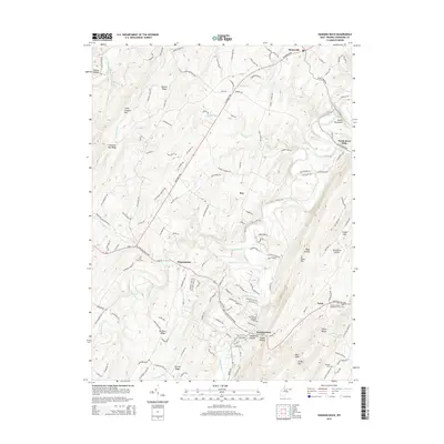
2014 Map of Hanging Rock
USGS Topo · Published 2014About this map
Slanesville and the winding course of the North River anchor this 2014 survey of Hampshire County. The landscape is defined by its deep hollows and high ridges, including Mouser Ridge, River Mtn, and Devils Backbone, which create a natural isolation for small settlements like Hoy and Loom. Transportation follows the contours of the land, centered on the historic Northwestern Pike and the Bloomery Pike, which connect these rural communities to the broader region.
Find a feature on this map
42 named features on this map. Tap any name to fly to it.
Don’t see what you’re looking for? This feature index may not catch every label — zoom into the map to look around manually.
Map Details
Editions of this 2014 Hanging Rock Map
This is the sole edition of this map. No revisions or reprints were ever made.
Other maps of this area

1891 · Romney
USGS Topo · 1:125,000

1894 · Winchester
USGS Topo · 1:125,000

1916 · Capon Bridge
USGS Topo · 1:62,500

1921 · Hanging Rock
USGS Topo · 1:48,000

1922 · Wardensville
USGS Topo · 1:62,500

1923 · Middletown
USGS Topo · 1:62,500

1923 · Capon Bridge
USGS Topo · 1:62,500

1923 · Hanging Rock
USGS Topo · 1:62,500

1924 · Wardensville
USGS Topo · 1:62,500

1937 · Capon Bridge
USGS Topo · 1:48,000