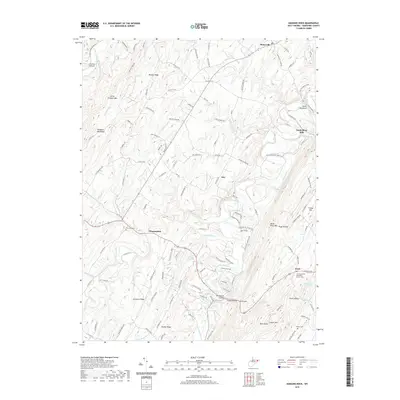
2019 Map of Hanging Rock
USGS Topo · Published 2019About this map
Slanesville and the surrounding highlands of Hampshire County are defined by a series of long, parallel ridges and deep river valleys that shape the local settlement pattern. The landscape is carved by the Little Cacapon River and the North River, with several smaller waterways like Tear Coat Cr and Turkeyfoot Run cutting through the terrain. Evidence of the area's rural heritage is found in concentrated pockets such as North River Mills and Loom, while community history is preserved at the Central United Methodist Church Cem and Quaker Cem. The map reveals a network of mountain roads and ridges including Mouser Ridge, Dunmore Ridge, and Brushy Ridge, which historically dictated the movement of residents between small locales like Hoy and the notable landmark at Hanging Rock.
Find a feature on this map
137 named features on this map. Tap any name to fly to it.
Don’t see what you’re looking for? This feature index may not catch every label — zoom into the map to look around manually.
Map Details
Editions of this 2019 Hanging Rock Map
This is the sole edition of this map. No revisions or reprints were ever made.
Other maps of this area

1891 · Romney
USGS Topo · 1:125,000

1894 · Winchester
USGS Topo · 1:125,000

1916 · Capon Bridge
USGS Topo · 1:62,500

1921 · Hanging Rock
USGS Topo · 1:48,000

1922 · Wardensville
USGS Topo · 1:62,500

1923 · Middletown
USGS Topo · 1:62,500

1923 · Capon Bridge
USGS Topo · 1:62,500

1923 · Hanging Rock
USGS Topo · 1:62,500

1924 · Wardensville
USGS Topo · 1:62,500

1937 · Capon Bridge
USGS Topo · 1:48,000