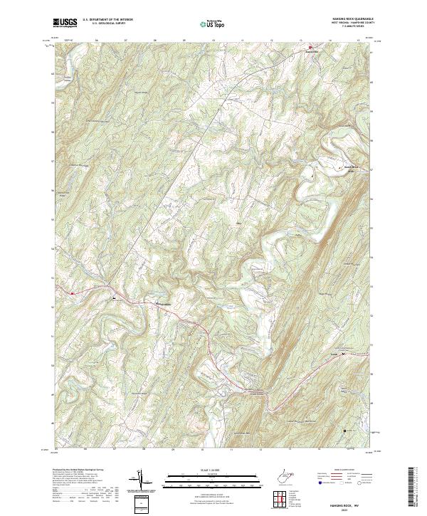
2023 Map of Hanging Rock
USGS Topo · Published 2023About this map
Hanging Rock stands as a prominent landmark in this section of Hampshire County, where the North River carves a deep valley through the Appalachian ridges. The map reveals a settlement pattern largely dictated by the area's steep terrain, with communities like North River Mills and Slanesville positioned along primary transit corridors. Local history is etched into the landscape through features like the Tear Coat Cem near Pleasantdale and the Quaker Cem to the south. The drainage network is complex, featuring Bearwallow Creek, Tear Coat Creek, and Edwards Run, which support the small agricultural valleys of Parks Valley and Henderson Hollow. High elevations are dominated by Little Cacapon Mountain and North River Mtn, while unique geological formations such as the Devils Backbone and Bens Knob define the horizon. This 2023 survey provides an exacting look at the modern road network, including Zion Church Rd and Offutt School Rd, which link these long-standing rural hamlets.
Find a feature on this map
139 named features on this map. Tap any name to fly to it.
Don’t see what you’re looking for? This feature index may not catch every label — zoom into the map to look around manually.
Map Details
Editions of this 2023 Hanging Rock Map
This is the sole edition of this map. No revisions or reprints were ever made.
Other maps of this area

1891 · Romney
USGS Topo · 1:125,000

1894 · Winchester
USGS Topo · 1:125,000

1916 · Capon Bridge
USGS Topo · 1:62,500

1921 · Hanging Rock
USGS Topo · 1:48,000

1922 · Wardensville
USGS Topo · 1:62,500

1923 · Middletown
USGS Topo · 1:62,500

1923 · Capon Bridge
USGS Topo · 1:62,500

1923 · Hanging Rock
USGS Topo · 1:62,500

1924 · Wardensville
USGS Topo · 1:62,500

1937 · Capon Bridge
USGS Topo · 1:48,000