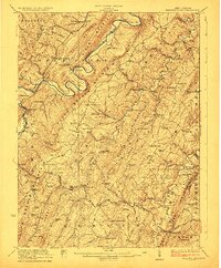
1923 Map of Hanging Rock
USGS Topo · Published 1923About this map
Northwestern Turnpike cuts through the ridges of Hampshire County, anchoring a network of small upland communities during the early twentieth century. This survey documents a landscape of self-sufficient settlements, defined by milling operations like Ellesons Mill, Barnes Mill, and the community at North River Mills. The topography is dominated by the parallel ridges of South Branch Mountain and Little Cacapon Mountain, which channel the flow of the South Branch Potomac River and the Cacapon River.
Find a feature on this map
112 named features on this map. Tap any name to fly to it.
Don’t see what you’re looking for? This feature index may not catch every label — zoom into the map to look around manually.
Map Details
Editions of this 1923 Hanging Rock Map
4 editions found

Other maps of this area

1891 · Romney
USGS Topo · 1:125,000

1894 · Winchester
USGS Topo · 1:125,000

1898 · Frostburg
USGS Topo · 1:62,500

1898 · Paw Paw
USGS Topo · 1:62,500

1899 · Flintstone
USGS Topo · 1:62,500

1900 · Pawpaw
USGS Topo · 1:62,500

1900 · Flintstone
USGS Topo · 1:62,500

1901 · Frostburg
USGS Topo · 1:62,500

1908 · Frostburg
USGS Topo · 1:62,500

1910 · Paw Paw
USGS Topo · 1:62,500