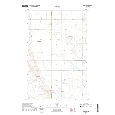
2017 Map of Hanks Corner
USGS Topo · Published 2017About this map
The boundary between Cavalier and Pembina counties bisects this North Dakota landscape, where the agricultural grid meets the winding drainages of the Little Pembina River and Tongue River. The small settlement of Hanks Corner serves as a focal point near the southern edge, situated at the intersection of Hanks Rd and Co Rd 6. This 2017 survey details a rural region defined by its water management and memorial sites, including the Weiler Dam Reservoir and several small burial grounds such as Beaulieu Cem, Spangel Cem, and Oak Lawn Cem. The terrain is marked by significant natural coulees like Smith Coulee and Busse Coulee, which disrupt the otherwise orderly township and range lines. This modern topographic record is valuable for tracing family history and land ownership patterns across the t161n r57w and t162n r56w sections of the Red River Valley hinterlands.
Find a feature on this map
35 named features on this map. Tap any name to fly to it.
Don’t see what you’re looking for? This feature index may not catch every label — zoom into the map to look around manually.
Map Details
Editions of this 2017 Hanks Corner Map
This is the sole edition of this map. No revisions or reprints were ever made.
Other maps of this area

1918 · Walhalla
USGS Topo · 1:62,500

1943 · Walhalla
USGS Topo · 1:62,500

1952 · Thief River Falls
USGS Topo · 1:250,000

1953 · Devils Lake
USGS Topo · 1:250,000

1956 · Thief River Falls
USGS Topo · 1:250,000

1956 · Devils Lake
USGS Topo · 1:250,000

1957 · Thief River Falls
USGS Topo · 1:250,000

1964 · Mountain
USGS Topo · 1:24,000

1964 · Hallson
USGS Topo · 1:24,000

1964 · Leroy
USGS Topo · 1:24,000