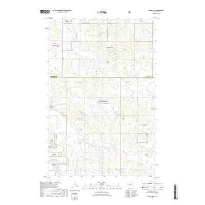
2017 Map of Hanks Gully
USGS Topo · Published 2017About this map
Little Missouri National Grassland dominates this landscape, where the rugged terrain of McKenzie and Billings counties is defined by the winding course of the Little Missouri River. The map captures a region primarily utilized for energy production and cattle grazing, anchored by the Roughrider Oil Field in the north. Transport through this dissected plateau relies on routes like Rough Rider Rd and Magpie Rd, which navigate the complex system of coulees and buttes. Distinctive landmarks such as Buckhorn Butte, Cedar Top Butte, and Anderson Butte rise above the drainage basins of Magpie Cr and Whitetail Cr. This 2017 survey details the topographical challenges of the area, including narrow passages like Devils Pass and the steep erosion of Hanks Gully, reflecting the enduring character of the North Dakota badlands.
Find a feature on this map
28 named features on this map. Tap any name to fly to it.
Don’t see what you’re looking for? This feature index may not catch every label — zoom into the map to look around manually.
Map Details
Editions of this 2017 Hanks Gully Map
This is the sole edition of this map. No revisions or reprints were ever made.
Other maps of this area

1953 · Watford City
USGS Topo · 1:250,000

1957 · Watford City
USGS Topo · 1:250,000

1963 · Gorham NW
USGS Topo · 1:24,000

1967 · Watford City
USGS Topo · 1:250,000

1970 · Eagle Draw
USGS Topo · 1:24,000

1970 · Hanks Gully
USGS Topo · 1:24,000

1970 · Roosevelt Creek East
USGS Topo · 1:24,000

1974 · Wolf Coulee
USGS Topo · 1:24,000

1974 · Squaretop Butte
USGS Topo · 1:24,000

1974 · Roosevelt Creek West
USGS Topo · 1:24,000