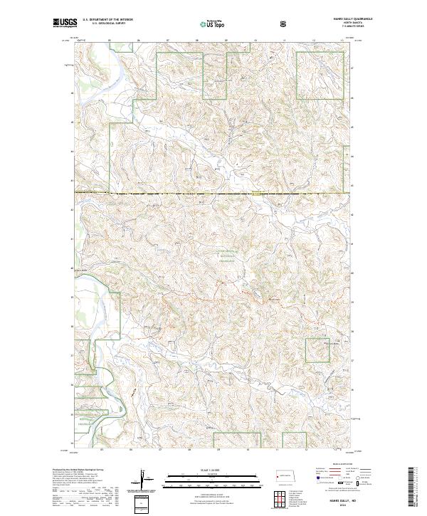
2024 Map of Hanks Gully
USGS Topo · Published 2024About this map
The Little Missouri National Grassland dominates this section of the North Dakota badlands, where the Little Missouri River carves a winding path through the western edge of the quadrangle. This modern survey illustrates the intersection of energy production and public land management, centered on the Roughrider Oil Field in the north. The landscape is defined by high points like Buckhorn Butte and Anderson Butte, while the drainage network includes Whitetail Creek and Fantail Creek. Local transportation and recreation are represented by the rugged Rough Rider Rd and the Maah Daah Hey Trl, a well-known route for exploring the broken terrain near Devils Pass and Goats Pass. The map serves as a contemporary record of the McKenzie and Billings County line and the ongoing industrial activity within this protected grassland environment.
Find a feature on this map
25 named features on this map. Tap any name to fly to it.
Don’t see what you’re looking for? This feature index may not catch every label — zoom into the map to look around manually.
Map Details
Editions of this 2024 Hanks Gully Map
This is the sole edition of this map. No revisions or reprints were ever made.
Other maps of this area

1953 · Watford City
USGS Topo · 1:250,000

1957 · Watford City
USGS Topo · 1:250,000

1963 · Gorham NW
USGS Topo · 1:24,000

1967 · Watford City
USGS Topo · 1:250,000

1970 · Eagle Draw
USGS Topo · 1:24,000

1970 · Hanks Gully
USGS Topo · 1:24,000

1970 · Roosevelt Creek East
USGS Topo · 1:24,000

1974 · Wolf Coulee
USGS Topo · 1:24,000

1974 · Squaretop Butte
USGS Topo · 1:24,000

1974 · Roosevelt Creek West
USGS Topo · 1:24,000