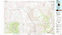
1980 Map of Hanksville
USGS Topo · Published 1987About this map
Hanksville stands at the junction of Utah 24 and the Fremont River during the late 1970s and early 1980s, serving as a gateway to the high-desert landscapes of south-central Utah. The map reveals a transition from the agricultural valley of the Fremont into the expansive San Rafael Desert and the high elevations of the Henry Mountains. The region's geography is defined by deep erosion, from the meandering Dirty Devil River to the complex formations of The Maze and the Orange Cliffs.
Find a feature on this map
64 named features on this map. Tap any name to fly to it.
Don’t see what you’re looking for? This feature index may not catch every label — zoom into the map to look around manually.
Map Details
Editions of this 1980 Hanksville Map
2 editions found
Other maps of this area

1885 · San Rafael
USGS Topo · 1:250,000

1885 · La Sal
USGS Topo · 1:250,000

1885 · Fish Lake
USGS Topo · 1:250,000

1886 · Escalante
USGS Topo · 1:250,000

1886 · Henry Mountains
USGS Topo · 1:250,000

1886 · Abajo
USGS Topo · 1:250,000

1892 · Abajo
USGS Topo · 1:250,000

1892 · Henry Mountains
USGS Topo · 1:250,000

1893 · Abajo
USGS Topo · 1:250,000

1896 · Fish Lake
USGS Topo · 1:250,000