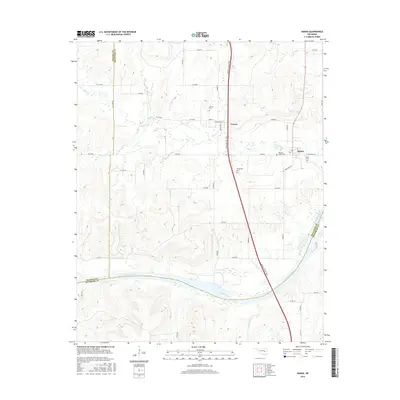
2016 Map of Hanna
USGS Topo · Published 2016About this map
Hanna and the nearby community of Vernon anchor this Oklahoma landscape at the borders of McIntosh, Hughes, and Pittsburg counties. The terrain is defined by the winding course of the Canadian River to the south and the Indian Nation Tpke cutting a north-south path through the center. This 2016 survey documents a rural environment where history is preserved in several localized burial grounds, including the Hawkins Family Cem and the Weogufkee Cem. A network of section line roads like E 1240 RD and N 4000 RD provides access to the interior, while Mill Cr and Scipio Creek drain the surrounding hills. The spatial arrangement of these small settlements and family landmarks reflects the persistent agrarian character of this corner of the state.
Find a feature on this map
42 named features on this map. Tap any name to fly to it.
Don’t see what you’re looking for? This feature index may not catch every label — zoom into the map to look around manually.
Map Details
Editions of this 2016 Hanna Map
This is the sole edition of this map. No revisions or reprints were ever made.
Other maps of this area

1900 · Canadian
USGS Topo · 1:125,000

1900 · Wewoka
USGS Topo · 1:125,000

1946 · Fort Smith
USGS Topo · 1:250,000

1954 · Oklahoma City
USGS Topo · 1:250,000

1957 · Oklahoma City
USGS Topo · 1:250,000

1962 · Raiford
USGS Topo · 1:24,000

1962 · Henryetta SW
USGS Topo · 1:24,000

1963 · Oklahoma City
USGS Topo · 1:250,000

1965 · Fort Smith
USGS Topo · 1:250,000

1967 · Fort Smith
USGS Topo · 1:250,000