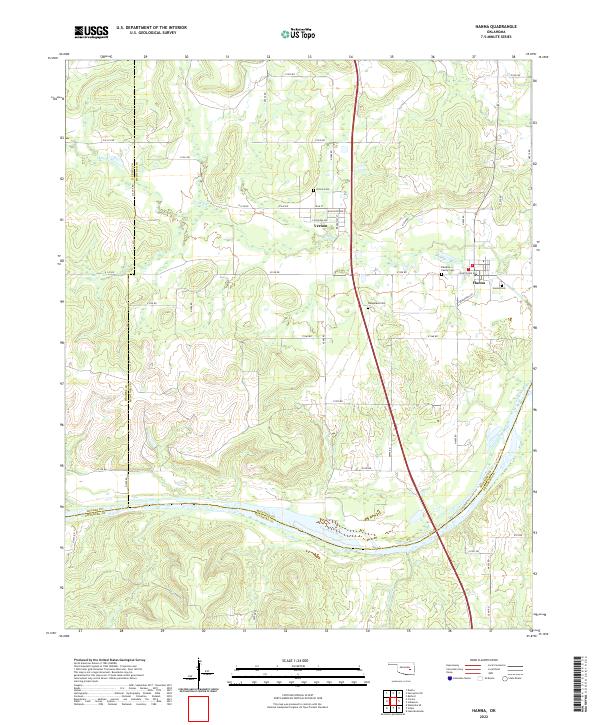
2022 Map of Hanna
USGS Topo · Published 2022About this map
Vernon and Hanna stand as central settlements in this Oklahoma landscape, which spans the intersection of McIntosh, Hughes, and Pittsburg counties. The terrain is defined by the significant southern sweep of the Canadian River, where Scipio Creek joins the larger waterway. The local road network is structured around a grid of rural routes like N 4000 RD and E 1250 RD, though the internal streets of Vernon—including Louisiana Ave, Mississippi Ave, and High ST—reveal a more concentrated historic town plan. This area reflects a quiet rural character, with continuity preserved through several burial grounds such as Vernon Cem and the Hawkins Family Cem. Small drainage systems like Mill Cr feed into the regional river basin, illustrating the natural geography that has shaped the placement of these crossroads communities over time.
Find a feature on this map
47 named features on this map. Tap any name to fly to it.
Don’t see what you’re looking for? This feature index may not catch every label — zoom into the map to look around manually.
Map Details
Editions of this 2022 Hanna Map
This is the sole edition of this map. No revisions or reprints were ever made.
Other maps of this area

1900 · Canadian
USGS Topo · 1:125,000

1900 · Wewoka
USGS Topo · 1:125,000

1946 · Fort Smith
USGS Topo · 1:250,000

1954 · Oklahoma City
USGS Topo · 1:250,000

1957 · Oklahoma City
USGS Topo · 1:250,000

1962 · Raiford
USGS Topo · 1:24,000

1962 · Henryetta SW
USGS Topo · 1:24,000

1963 · Oklahoma City
USGS Topo · 1:250,000

1965 · Fort Smith
USGS Topo · 1:250,000

1967 · Fort Smith
USGS Topo · 1:250,000