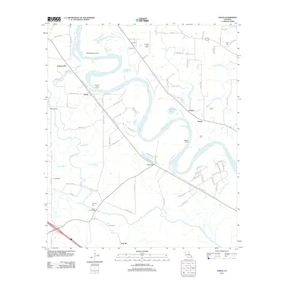
2012 Map of Hanna
USGS Topo · Published 2012About this map
The meandering course of the Red River defines the landscape of Natchitoches Parish in this 2012 survey, where complex water systems like Hollingsworth Cutoff and Horseshoe Bayou reveal the river's historical shifts. Small river settlements and agricultural hubs like Hanna, Piermont, and Lake End are connected by a network of parish roads, reflecting a community tied closely to the fertile bottomlands. Industrial activity is evident through the Red Oak Oil and Gas Field and the Lake End Oil Field, which punctuate the rural terrain near the banks of Bayou Pierre and Jims River. Genealogists will find significant local history at several burial sites, including Union Hall Cem, Browne Cem, and Haley Cem. The presence of The Red River Airport and the local Po in Hanna highlight the area's continued role as a functional crossroads in the early 21st century.
Find a feature on this map
90 named features on this map. Tap any name to fly to it.
Don’t see what you’re looking for? This feature index may not catch every label — zoom into the map to look around manually.
Map Details
Editions of this 2012 Hanna Map
This is the sole edition of this map. No revisions or reprints were ever made.
Other maps of this area

1937 · Campti NW
USGS Topo · 1:31,680

1937 · Campti SW
USGS Topo · 1:31,680

1938 · Chemard Lake
USGS Topo · 1:31,680

1938 · Hollis Creek
USGS Topo · 1:31,680

1938 · Allen
USGS Topo · 1:31,680

1938 · Lake End
USGS Topo · 1:31,680

1944 · Campti
USGS Topo · 1:62,500

1947 · Ashland
USGS Topo · 1:62,500

1947 · Hanna
USGS Topo · 1:62,500

1948 · Coushatta
USGS Topo · 1:62,500