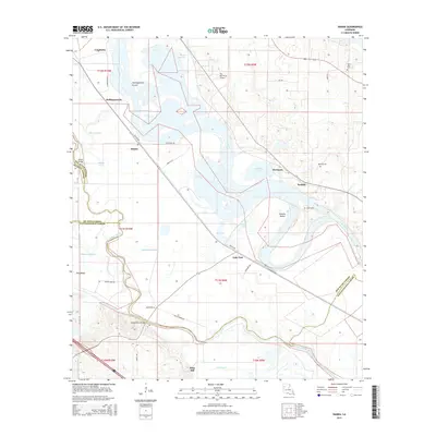
2015 Map of Hanna
USGS Topo · Published 2015About this map
Red River currents and oxbow remnants define the geography of this Natchitoches and Red River Parish borderland. The landscape is a complex network of active and former channels, including Hollingsworth Cutoff, Old Lake, and the winding Bayou Pierre. Small settlements like Hanna and Lake End are linked by rural routes such as Sam Lee Rd and Prince Rd, which navigate the low-lying terrain between the river and the surrounding hills.
Find a feature on this map
52 named features on this map. Tap any name to fly to it.
Don’t see what you’re looking for? This feature index may not catch every label — zoom into the map to look around manually.
Map Details
Editions of this 2015 Hanna Map
This is the sole edition of this map. No revisions or reprints were ever made.
Other maps of this area

1937 · Campti NW
USGS Topo · 1:31,680

1937 · Campti SW
USGS Topo · 1:31,680

1938 · Chemard Lake
USGS Topo · 1:31,680

1938 · Hollis Creek
USGS Topo · 1:31,680

1938 · Allen
USGS Topo · 1:31,680

1938 · Lake End
USGS Topo · 1:31,680

1944 · Campti
USGS Topo · 1:62,500

1947 · Ashland
USGS Topo · 1:62,500

1947 · Hanna
USGS Topo · 1:62,500

1948 · Coushatta
USGS Topo · 1:62,500