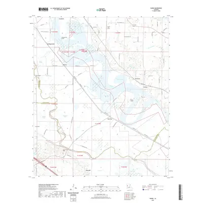
2020 Map of Hanna
USGS Topo · Published 2020About this map
The Red River carves a winding path through this corner of Northwest Louisiana, defining the boundaries between Red River, De Soto, and Natchitoches Parishes. The landscape is characterized by complex hydrography, including the Hollingsworth Cutoff and numerous oxbow features like Horseshoe Bayou, Red Oak Lake, and Porters Lake. Small riverfront settlements such as Lake End, Hanna, and Redoak are connected by a network of parish roads and state routes like La 174, illustrating the rural transit patterns of the Red River Valley. For genealogists, the map identifies several family-named landmarks and burial sites, including Hall Cem, Browne Cem, and Haley Cem. The presence of The Red River Airport and the Jordon Ferry Bridge provides a look at local infrastructure alongside natural features like Porters Island and the meandering Bayou Pierre and Jims River.
Find a feature on this map
81 named features on this map. Tap any name to fly to it.
Don’t see what you’re looking for? This feature index may not catch every label — zoom into the map to look around manually.
Map Details
Editions of this 2020 Hanna Map
This is the sole edition of this map. No revisions or reprints were ever made.
Other maps of this area

1937 · Campti NW
USGS Topo · 1:31,680

1937 · Campti SW
USGS Topo · 1:31,680

1938 · Chemard Lake
USGS Topo · 1:31,680

1938 · Hollis Creek
USGS Topo · 1:31,680

1938 · Allen
USGS Topo · 1:31,680

1938 · Lake End
USGS Topo · 1:31,680

1944 · Campti
USGS Topo · 1:62,500

1947 · Ashland
USGS Topo · 1:62,500

1947 · Hanna
USGS Topo · 1:62,500

1948 · Coushatta
USGS Topo · 1:62,500