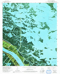
1992 Map of Hanna
USGS Topo · Published 1992About this map
Port Sulphur and the neighboring settlements of Happy Jack and Encalade anchor the narrow habitable corridor between the Mississippi River and the expanding marshlands of Plaquemines Parish. This orthophotomap, updated in the early 1990s, illustrates the precarious balance of the lower coast, where the Back Levee protects local infrastructure from the labyrinth of bays and bayous like Battle Ground Bay and Felicity Bay. Local genealogy is preserved in the presence of McBride Sch and a local Cem, alongside industrial markers like the Radio Towers (KPLT). The landscape is defined by the hydrologic engineering of Potters Canal and John Canal, which cut through the wetlands toward the American Bay. This survey captures the region's complex shoreline before further coastal erosion, marking features such as Drum Island and Pintail Point within the larger La Fourche Bay system.
Find a feature on this map
48 named features on this map. Tap any name to fly to it.
Don’t see what you’re looking for? This feature index may not catch every label — zoom into the map to look around manually.
Map Details
Editions of this 1992 Hanna Map
This is the sole edition of this map. No revisions or reprints were ever made.
Other maps of this area

1937 · Campti NW
USGS Topo · 1:31,680

1937 · Campti SW
USGS Topo · 1:31,680

1938 · Chemard Lake
USGS Topo · 1:31,680

1938 · Hollis Creek
USGS Topo · 1:31,680

1938 · Allen
USGS Topo · 1:31,680

1938 · Lake End
USGS Topo · 1:31,680

1944 · Campti
USGS Topo · 1:62,500

1947 · Ashland
USGS Topo · 1:62,500

1947 · Hanna
USGS Topo · 1:62,500

1948 · Coushatta
USGS Topo · 1:62,500