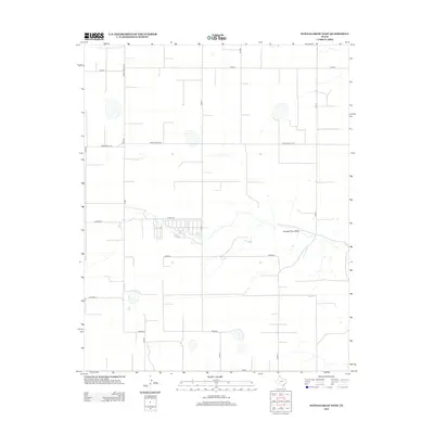
2012 Map of Hannas Draw West
USGS Topo · Published 2012About this map
Hannas Draw Valley cuts through the high plains of the Texas Panhandle in this 2012 survey, revealing the sparse, geometric settlement pattern of Sherman County. The landscape is defined by its vast agricultural grid, where long county roads like Co Rd S and Co Rd Z stretch for miles across the level terrain. Major thoroughfares including Ranch Road 1573 and Ranch Road 2018 provide the primary transit through this rural ranching and farming district. The map captures the specialized land use of the region, where occasional clusters of infrastructure near Co Rd W and the southern reach of Fm-520 suggest localized agricultural operations. For researchers, the map provides a precise look at the 21st-century road network and the natural drainage paths that have influenced land ownership and ranching boundaries for generations.
Find a feature on this map
16 named features on this map. Tap any name to fly to it.
Don’t see what you’re looking for? This feature index may not catch every label — zoom into the map to look around manually.
Map Details
Editions of this 2012 Hannas Draw West Map
This is the sole edition of this map. No revisions or reprints were ever made.
Other maps of this area

1954 · Perryton
USGS Topo · 1:250,000

1958 · Perryton
USGS Topo · 1:250,000

1972 · Capps Switch
USGS Topo · 1:24,000

1973 · Gruver
USGS Topo · 1:24,000

1974 · Morse
USGS Topo · 1:24,000

1974 · Hannas Draw East
USGS Topo · 1:24,000
1974 · Capps Switch SE
USGS Topo · 1:24,000

1974 · Sunray 1 SW
USGS Topo · 1:24,000

1974 · Sunray 1 SE
USGS Topo · 1:24,000

1974 · Capps Switch NW
USGS Topo · 1:24,000