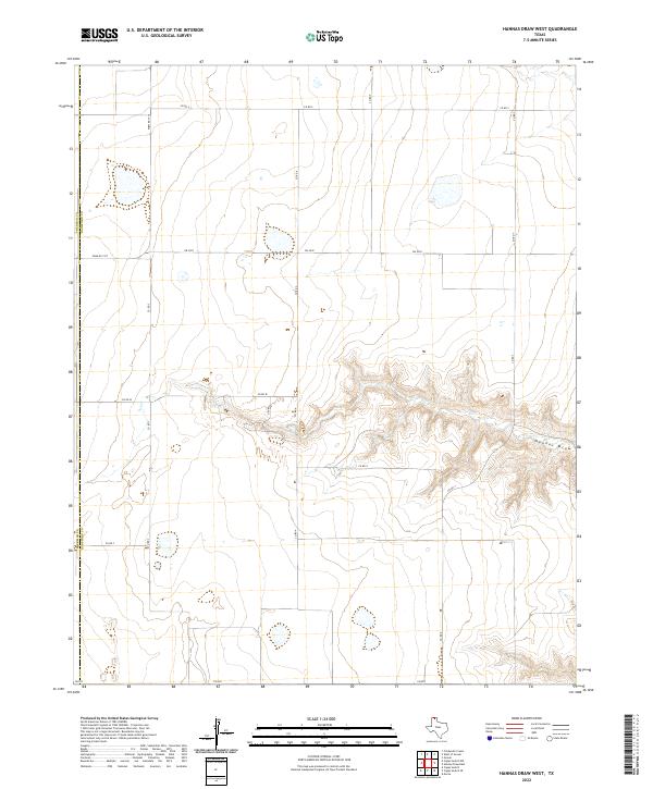
2022 Map of Hannas Draw West
USGS Topo · Published 2022About this map
The county line between Sherman Co and Hansford Co bisects this high plains landscape, where the flat agricultural terrain is dramatically interrupted by the erosional systems of Hannas Draw. In the eastern half of the map, the topography drops away into a complex of fingers and drainages that feed toward the draw, creating a stark contrast to the gridded section lines above. A network of rural arteries, including Farm Rd 1573 and Fm 2018, facilitates transport across this remote corner of the Texas Panhandle. The map reveals the classic rural infrastructure of the region, where straight-line ranch roads like Co Rd S and Co Rd 4 meet the winding natural contours of the local hydrography.
Find a feature on this map
14 named features on this map. Tap any name to fly to it.
Don’t see what you’re looking for? This feature index may not catch every label — zoom into the map to look around manually.
Map Details
Editions of this 2022 Hannas Draw West Map
This is the sole edition of this map. No revisions or reprints were ever made.
Other maps of this area

1954 · Perryton
USGS Topo · 1:250,000

1958 · Perryton
USGS Topo · 1:250,000

1972 · Capps Switch
USGS Topo · 1:24,000

1973 · Gruver
USGS Topo · 1:24,000

1974 · Morse
USGS Topo · 1:24,000

1974 · Hannas Draw East
USGS Topo · 1:24,000
1974 · Capps Switch SE
USGS Topo · 1:24,000

1974 · Sunray 1 SW
USGS Topo · 1:24,000

1974 · Sunray 1 SE
USGS Topo · 1:24,000

1974 · Capps Switch NW
USGS Topo · 1:24,000