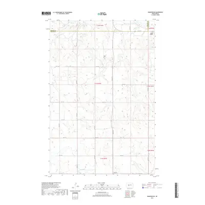
2018 Map of Hannover NE
USGS Topo · Published 2018About this map
Fort Clark stands at the northeastern edge of this prairie landscape, where the borders of Mercer and Oliver counties meet. The area is defined by the drainage patterns of Clarks Cr and Square Butte Cr, which carve through the high ground in the Missouri River watershed. Settlement patterns here are sparsely distributed across the section lines of the Public Land Survey System, with local genealogy interests centered on family and congregational burial grounds. Bagley Cem is located centrally in the township, while Saint Pauls Lutheran Cem serves the community further south near the section line of 20th St SW. The map reflects the enduring rural character of these townships, where development is primarily focused on the established grid of county roads that navigate the varying elevations between the creek beds.
Find a feature on this map
23 named features on this map. Tap any name to fly to it.
Don’t see what you’re looking for? This feature index may not catch every label — zoom into the map to look around manually.
Map Details
Editions of this 2018 Hannover NE Map
This is the sole edition of this map. No revisions or reprints were ever made.
Other maps of this area

1948 · Stanton
USGS Topo · 1:62,500

1949 · Stanton
USGS Topo · 1:62,500

1949 · Washburn
USGS Topo · 1:62,500

1954 · McClusky
USGS Topo · 1:250,000

1958 · McClusky
USGS Topo · 1:250,000

1967 · Washburn SW
USGS Topo · 1:24,000

1967 · Stanton SE
USGS Topo · 1:24,000

1968 · Hannover NE
USGS Topo · 1:24,000

1968 · Fort Clark
USGS Topo · 1:24,000

1968 · Stanton
USGS Topo · 1:24,000