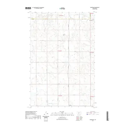
2020 Map of Hannover NE
USGS Topo · Published 2020About this map
Fort Clark sits at the northeastern corner of this rural landscape, marking a historical point of settlement near the border of Mercer and Oliver counties. The terrain is defined by a dendritic drainage pattern of prairie creeks, including Square Butte Cr in the south and Clerks Cr and Chardon Cr to the north. These waterways cut through the high ground as they move toward the Missouri River valley just beyond the map's edge. The rural infrastructure follows a rigid section-line grid, typical of the Great Plains, where numbered roads like 12th St SW and 18th St SW connect isolated farmsteads and communal landmarks. For genealogists and local historians, the presence of Bagley Cem and Saint Pauls Lutheran Cem provides specific points of interest for tracing early families in the region.
Find a feature on this map
23 named features on this map. Tap any name to fly to it.
Don’t see what you’re looking for? This feature index may not catch every label — zoom into the map to look around manually.
Map Details
Editions of this 2020 Hannover NE Map
This is the sole edition of this map. No revisions or reprints were ever made.
Other maps of this area

1948 · Stanton
USGS Topo · 1:62,500

1949 · Stanton
USGS Topo · 1:62,500

1949 · Washburn
USGS Topo · 1:62,500

1954 · McClusky
USGS Topo · 1:250,000

1958 · McClusky
USGS Topo · 1:250,000

1967 · Washburn SW
USGS Topo · 1:24,000

1967 · Stanton SE
USGS Topo · 1:24,000

1968 · Hannover NE
USGS Topo · 1:24,000

1968 · Fort Clark
USGS Topo · 1:24,000

1968 · Stanton
USGS Topo · 1:24,000