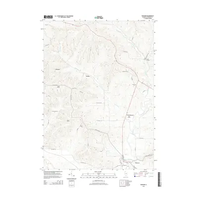
2015 Map of Hanover
USGS Topo · Published 2015About this map
Hanover sits along the southern edge of this Jo Daviess County landscape, situated near the banks where the Apple River flows through the terrain. The topography is defined by a dense network of valleys, including Irish Hollow, Snipe Hollow, and Long Hollow, which dictate the winding paths of rural roads such as W Blackjack Rd and S Girot Hill Rd. Small settlements like Rodden and Winston are scattered across the higher ground, while North Hanover marks a distinct cluster further upriver.
Find a feature on this map
47 named features on this map. Tap any name to fly to it.
Don’t see what you’re looking for? This feature index may not catch every label — zoom into the map to look around manually.
Map Details
Editions of this 2015 Hanover Map
This is the sole edition of this map. No revisions or reprints were ever made.
Other maps of this area

1892 · Savanna
USGS Topo · 1:62,500

1911 · Elizabeth
USGS Topo · 1:62,500

1911 · Galena
USGS Topo · 1:62,500

1913 · Galena
USGS Topo · 1:62,500

1935 · Miles
USGS Topo · 1:62,500

1936 · Elizabeth
USGS Topo · 1:62,500

1941 · Miles
USGS Topo · 1:62,500

1952 · Savanna
USGS Topo · 1:62,500

1953 · Blackhawk
USGS Topo · 1:24,000

1953 · Green Island
USGS Topo · 1:24,000