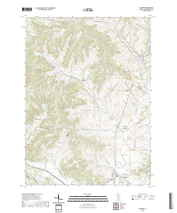
2024 Map of Hanover
USGS Topo · Published 2024About this map
The Apple River meanders through this section of Jo Daviess County, anchoring the settlements of Hanover and North Hanover in a landscape defined by deep valleys and timbered ridges. To the southwest, the Upper Mississippi River National Wildlife and Fish Refuge marks the transition toward the river's edge, while the interior is etched with numerous named ravines such as Irish Hollow, Long Hollow, and Beaty Hollow.
Find a feature on this map
52 named features on this map. Tap any name to fly to it.
Don’t see what you’re looking for? This feature index may not catch every label — zoom into the map to look around manually.
Map Details
Editions of this 2024 Hanover Map
This is the sole edition of this map. No revisions or reprints were ever made.
Other maps of this area

1892 · Savanna
USGS Topo · 1:62,500

1911 · Elizabeth
USGS Topo · 1:62,500

1911 · Galena
USGS Topo · 1:62,500

1913 · Galena
USGS Topo · 1:62,500

1935 · Miles
USGS Topo · 1:62,500

1936 · Elizabeth
USGS Topo · 1:62,500

1941 · Miles
USGS Topo · 1:62,500

1952 · Savanna
USGS Topo · 1:62,500

1953 · Blackhawk
USGS Topo · 1:24,000

1953 · Green Island
USGS Topo · 1:24,000