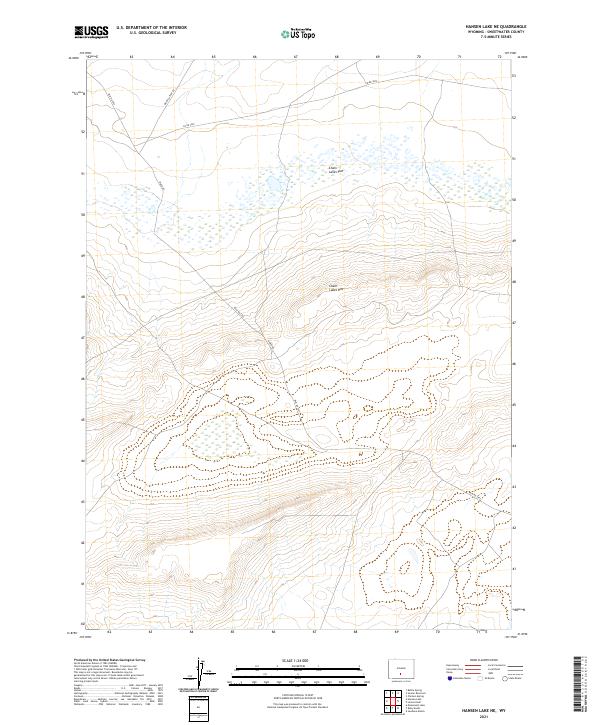
2021 Map of Hansen Lake NE
USGS Topo · Published 2021About this map
Chain Lakes Flat dominates this high-desert landscape in Sweetwater County, where intricate wetlands and small ponds are scattered across a broad, arid basin. This 2021 survey reveals a remote section of Wyoming defined by the dramatic change in elevation at the Chain Lakes Rim, which marks a significant topographical break in the terrain. The map records a sparse network of service and county roads essential for land management and access to this isolated region, including Riner Rd and the Riner Cutoff Rd. These routes, along with Co Rd 3202, reflect the modern infrastructure required to navigate the vast distances between the seasonal waters of the flats and the surrounding rangeland. The presence of these named roads and defined township boundaries like t23n r92w provides a clear framework for researchers tracking land use and access points in this corner of the state.
Find a feature on this map
10 named features on this map. Tap any name to fly to it.
Don’t see what you’re looking for? This feature index may not catch every label — zoom into the map to look around manually.
Map Details
Editions of this 2021 Hansen Lake NE Map
This is the sole edition of this map. No revisions or reprints were ever made.
Other maps of this area

1954 · Rawlins
USGS Topo · 1:250,000

1955 · Casper
USGS Topo · 1:250,000

1958 · Rawlins
USGS Topo · 1:250,000

1958 · Casper
USGS Topo · 1:250,000

1960 · Battle Spring
USGS Topo · 1:24,000

1960 · Hansen Lake NE
USGS Topo · 1:24,000

1960 · Sooner Reservoir
USGS Topo · 1:24,000

1960 · Larsen Knoll
USGS Topo · 1:24,000

1960 · Hansen Lake
USGS Topo · 1:24,000

1960 · Chicken Spring
USGS Topo · 1:24,000