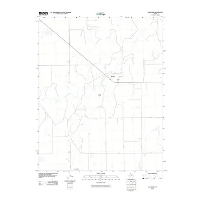
2010 Map of Hansford
USGS Topo · Published 2010About this map
Palo Duro Creek winds through the northern Texas Panhandle, anchoring a landscape defined by ranching and energy extraction in the early 21st century. The settlement of Hansford sits near the creek's upper reaches, accompanied by the Hansford Cemetery, which provides a vital link for those researching local family histories and early High Plains burials. The region's economic drivers are clearly marked by the Hansford Gas and Oil Field, which occupies a significant portion of the central terrain between F.M. 2018 and the southern reaches of the quadrangle. To the south, the community of McKibben serves as another focal point for residential and agricultural activity. The map reveals a strict grid of rural infrastructure, including Co RD 16 and Co RD 20, which facilitate movement between the drainages of Horse Creek and the surrounding rangeland.
Find a feature on this map
15 named features on this map. Tap any name to fly to it.
Don’t see what you’re looking for? This feature index may not catch every label — zoom into the map to look around manually.
Map Details
Editions of this 2010 Hansford Map
This is the sole edition of this map. No revisions or reprints were ever made.
Other maps of this area

1954 · Perryton
USGS Topo · 1:250,000

1958 · Perryton
USGS Topo · 1:250,000

1962 · Kimball
USGS Topo · 1:24,000

1962 · Hansford
USGS Topo · 1:24,000

1962 · Waka SW
USGS Topo · 1:24,000

1962 · Spearman
USGS Topo · 1:24,000

1973 · Gruver
USGS Topo · 1:24,000

1974 · Morse
USGS Topo · 1:24,000

1974 · Hannas Draw East
USGS Topo · 1:24,000
1974 · Holt
USGS Topo · 1:24,000