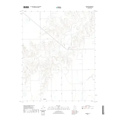
2019 Map of Hansford
USGS Topo · Published 2019About this map
Hansford Cem sits atop the dissected plateau of the Texas Panhandle, overlooking a landscape where the High Plains are deeply etched by the drainage of Horse Cr. This 2019 survey reveals a sparsely populated agricultural region defined more by its grid of county roads, such as Co RD 18 and Co RD X, than by urban centers. The settlement of McKibben anchors the southern portion of the quadrangle near the intersection of Co RD 16 and Co RD Z. The interplay between the flat tablelands and the sharp breaks of the creek valleys demonstrates the ongoing erosion of the Ogallala Formation, a defining characteristic of this portion of Hansford County. Transportation across these breaks is facilitated by a network of farm-to-market roads, including Fm 2018 and Fm 2387.
Find a feature on this map
15 named features on this map. Tap any name to fly to it.
Don’t see what you’re looking for? This feature index may not catch every label — zoom into the map to look around manually.
Map Details
Editions of this 2019 Hansford Map
This is the sole edition of this map. No revisions or reprints were ever made.
Other maps of this area

1954 · Perryton
USGS Topo · 1:250,000

1958 · Perryton
USGS Topo · 1:250,000

1962 · Kimball
USGS Topo · 1:24,000

1962 · Hansford
USGS Topo · 1:24,000

1962 · Waka SW
USGS Topo · 1:24,000

1962 · Spearman
USGS Topo · 1:24,000

1973 · Gruver
USGS Topo · 1:24,000

1974 · Morse
USGS Topo · 1:24,000

1974 · Hannas Draw East
USGS Topo · 1:24,000
1974 · Holt
USGS Topo · 1:24,000