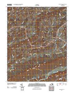
2010 Map of Hansonville
USGS Topo · Published 2010About this map
Dickensonville and Hansonville serve as primary anchors in this landscape of the Ridge and Valley province, where the terrain is strictly defined by parallel geological structures. The drainage of Big Moccasin Creek and the North Fork Holston River dictates the settlement pattern, forcing roads and small communities into the narrow lowlands of Poor Valley and Raccoon Valley. Prominent ridges such as Clinch Mountain and Moccasin Ridge create formidable barriers, breached only at strategic points like Hamilton Gap and Wooten Gap.
Find a feature on this map
47 named features on this map. Tap any name to fly to it.
Don’t see what you’re looking for? This feature index may not catch every label — zoom into the map to look around manually.
Map Details
Editions of this 2010 Hansonville Map
This is the sole edition of this map. No revisions or reprints were ever made.
Other maps of this area

1897 · Bristol
USGS Topo · 1:125,000

1902 · Bristol
USGS Topo · 1:125,000

1918 · Carterton
USGS Topo · 1:62,500

1920 · Coeburn
USGS Topo · 1:48,000
1934 · Lebanon
USGS Topo · 1:24,000

1934 · Wallace
USGS Topo · 1:24,000

1934 · Brumley
USGS Topo · 1:24,000

1934 · Hansonville
USGS Topo · 1:24,000
1934 · Carbo
USGS Topo · 1:24,000

1934 · Wyndale
USGS Topo · 1:24,000