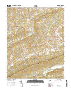
2016 Map of Hansonville
USGS Topo · Published 2016About this map
Clinch Mountain and Copper Ridge dominate this southwest Virginia landscape, framing a series of valleys defined by the Big Moccasin Cr and the North Fork Holston River. The settlement pattern follows the contours of the land, with Dickensonville and Hansonville serving as primary hubs along the mountain corridors. Local history is deeply embedded in the terrain, from the narrow passages of Meetinghouse Gap and Hamilton Gap to the evocative names of Lick Skillet Hollow and Chapin Hollow.
Find a feature on this map
91 named features on this map. Tap any name to fly to it.
Don’t see what you’re looking for? This feature index may not catch every label — zoom into the map to look around manually.
Map Details
Editions of this 2016 Hansonville Map
This is the sole edition of this map. No revisions or reprints were ever made.
Other maps of this area

1897 · Bristol
USGS Topo · 1:125,000

1902 · Bristol
USGS Topo · 1:125,000

1918 · Carterton
USGS Topo · 1:62,500

1920 · Coeburn
USGS Topo · 1:48,000
1934 · Lebanon
USGS Topo · 1:24,000

1934 · Wallace
USGS Topo · 1:24,000

1934 · Brumley
USGS Topo · 1:24,000

1934 · Hansonville
USGS Topo · 1:24,000
1934 · Carbo
USGS Topo · 1:24,000

1934 · Wyndale
USGS Topo · 1:24,000