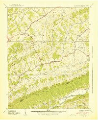
1939 Map of Hansonville
USGS Topo · Published 1939About this map
Clinch Mountain and Copper Ridge dominate the southwest Virginia landscape in this 1930s topographic study, defining a series of narrow valleys where agriculture and small settlements took root. The settlement of Hansonville serves as a central point where several forks of Moccasin Creek converge before the stream cuts westward. The map reveals a deeply established rural infrastructure of the era, marked by numerous local institutions such as the Stony Point Sch and Cedar Grove Ch.
Find a feature on this map
55 named features on this map. Tap any name to fly to it.
Don’t see what you’re looking for? This feature index may not catch every label — zoom into the map to look around manually.
Map Details
Editions of this 1939 Hansonville Map
2 editions found
Other maps of this area

1897 · Bristol
USGS Topo · 1:125,000

1902 · Bristol
USGS Topo · 1:125,000

1918 · Carterton
USGS Topo · 1:62,500

1920 · Coeburn
USGS Topo · 1:48,000
1934 · Lebanon
USGS Topo · 1:24,000

1934 · Wallace
USGS Topo · 1:24,000

1934 · Brumley
USGS Topo · 1:24,000

1934 · Hansonville
USGS Topo · 1:24,000
1934 · Carbo
USGS Topo · 1:24,000

1934 · Wyndale
USGS Topo · 1:24,000