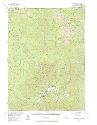
1956 Map of Happy Camp
USGS Topo · Published 1961About this map
Happy Camp sits at the confluence of Indian Creek and the Klamath river system, serving as a primary hub for the region's extraction and forestry economy in the mid-1950s. The landscape is heavily marked by its mining heritage, from the large operations at the Grey Eagle Mine and Classic Hill Mine to the China Cr Placer Mine and Richardson Bedrock Mine. This survey documents a complex network of trails and resource infrastructure, including the Millpond Substation and the remote West Branch Guard Sta.
Find a feature on this map
134 named features on this map. Tap any name to fly to it.
Don’t see what you’re looking for? This feature index may not catch every label — zoom into the map to look around manually.
Map Details
Editions of this 1956 Happy Camp Map
3 editions found

Other maps of this area

1908 · Grants Pass
USGS Topo · 1:125,000

1914 · Seiad
USGS Topo · 1:125,000

1917 · Kerby
USGS Topo · 1:125,000

1918 · Kerby
USGS Topo · 1:125,000

1922 · Preston Peak
USGS Topo · 1:125,000

1922 · Seiad
USGS Topo · 1:125,000

1945 · Kerby
USGS Topo · 1:125,000

1948 · Weed
USGS Topo · 1:250,000

1950 · Weed
USGS Topo · 1:250,000

1954 · Cave Junction
USGS Topo · 1:62,500