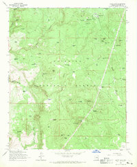
1965 Map of Happy Jack
USGS Topo · Published 1970About this map
Coconino National Forest defines the landscape of this high-country survey, centered on the small settlement of Happy Jack. The mid-1960s mapping reveals a region managed for timber and range, marked by a sophisticated network of water catchments including Yellow Jacket Tank No 1, Monument Tanks, and Bottle Spring Tank. These features, along with numerous unnamed tanks and wells, trace the essential infrastructure required for forestry and livestock in the arid Southwest.
Find a feature on this map
63 named features on this map. Tap any name to fly to it.
Don’t see what you’re looking for? This feature index may not catch every label — zoom into the map to look around manually.
Map Details
Editions of this 1965 Happy Jack Map
3 editions found
Other maps of this area

1887 · Verde
USGS Topo · 1:250,000

1892 · Verde
USGS Topo · 1:250,000

1923 · Camp Verde
USGS Topo · 1:125,000

1932 · Camp Verde
USGS Topo · 1:125,000

1936 · Camp Verde
USGS Topo · 1:125,000

1954 · Holbrook
USGS Topo · 1:250,000

1957 · Holbrook
USGS Topo · 1:250,000

1958 · Holbrook
USGS Topo · 1:250,000

1960 · Holbrook
USGS Topo · 1:250,000
1965 · Long Valley
USGS Topo · 1:24,000