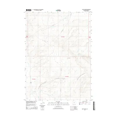
2015 Map of Happy Spring
USGS Topo · Published 2015About this map
The historical Emigrant Trl and the Continental Divide National Scenic Trail intersect this high-altitude landscape in Fremont County, Wyoming. The terrain is defined by a series of intermittent watercourses and significant geological landmarks like Bull Canyon and Coyote Gulch. Water sources, though potentially seasonal, are clearly marked and serve as vital anchors in the arid environment, including Happy Spring and Warm Springs.
Find a feature on this map
18 named features on this map. Tap any name to fly to it.
Don’t see what you’re looking for? This feature index may not catch every label — zoom into the map to look around manually.
Map Details
Editions of this 2015 Happy Spring Map
This is the sole edition of this map. No revisions or reprints were ever made.
Other maps of this area

1951 · Soap Holes
USGS Topo · 1:24,000

1951 · Myers Ranch
USGS Topo · 1:24,000

1953 · Barras Springs
USGS Topo · 1:24,000

1953 · Sweetwater Station
USGS Topo · 1:24,000

1953 · Happy Spring
USGS Topo · 1:24,000

1953 · Red Canyon
USGS Topo · 1:24,000

1955 · Lander
USGS Topo · 1:250,000
1957 · Red Canyon
USGS Topo · 1:24,000

1958 · Lander
USGS Topo · 1:250,000

1961 · Lander
USGS Topo · 1:250,000