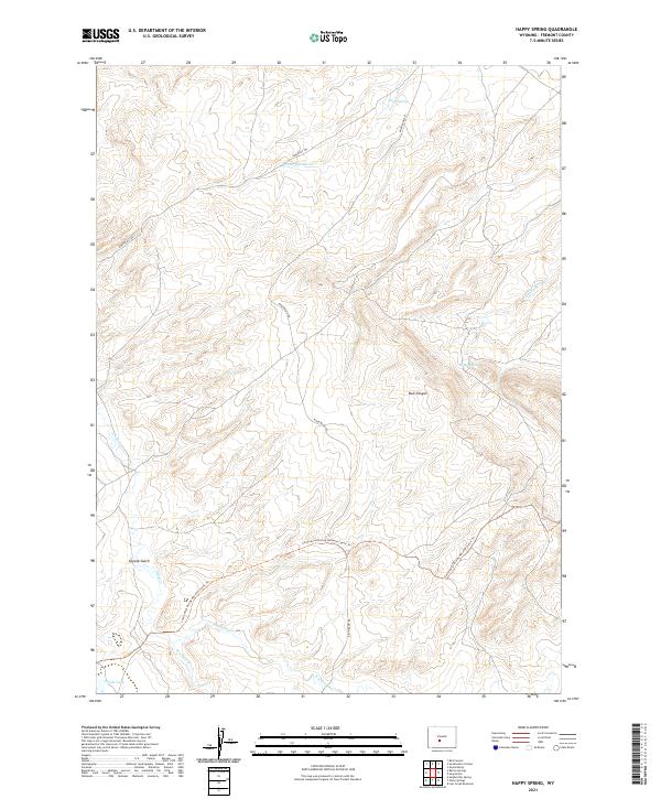
2021 Map of Happy Spring
USGS Topo · Published 2021About this map
Emigrant Trl and the Continental Divide National Scenic Trl converge in this high-altitude landscape in Fremont County, representing two distinct eras of overland travel. The terrain is defined by the drainage basins of Warm Springs Cr and Happy Spring Cr, which carve through a network of mesas and draws. Significant topographic features like Bull Canyon and Coyote Gulch reveal the geological character of the region. This 2021 survey also details the hydrological network surrounding Coyote Lake, including the various branches of Alkali Cr, W Alkali Cr, and E Alkali Cr. The presence of the Bison Basin Rd provides the primary modern access through this sparsely developed section of Wyoming, where surveyors have carefully recorded the legacy of historic trails alongside contemporary natural resource management data.
Find a feature on this map
17 named features on this map. Tap any name to fly to it.
Don’t see what you’re looking for? This feature index may not catch every label — zoom into the map to look around manually.
Map Details
Editions of this 2021 Happy Spring Map
This is the sole edition of this map. No revisions or reprints were ever made.
Other maps of this area

1951 · Soap Holes
USGS Topo · 1:24,000

1951 · Myers Ranch
USGS Topo · 1:24,000

1953 · Barras Springs
USGS Topo · 1:24,000

1953 · Sweetwater Station
USGS Topo · 1:24,000

1953 · Happy Spring
USGS Topo · 1:24,000

1953 · Red Canyon
USGS Topo · 1:24,000

1955 · Lander
USGS Topo · 1:250,000
1957 · Red Canyon
USGS Topo · 1:24,000

1958 · Lander
USGS Topo · 1:250,000

1961 · Lander
USGS Topo · 1:250,000