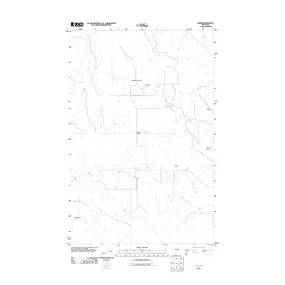
2011 Map of Harb
USGS Topo · Published 2011About this map
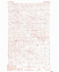
Harb serves as the central point in this prairie landscape of Valley County, Montana, where a network of water management features and seasonal drainages defines the local geography. The area's reliance on ranching and water conservation is evident through several named infrastructure projects, including Ohs Dam, Bruckner Number 2 Dam, and Chanlin Dam. These structures manage the flow through a series of traditional Montana coulees, such as Snowbank Coulee in the north and Pickhandle Coulee in the southwest. Transport through this rural expanse is anchored by Beaver Creek Rd, which cuts across the terrain to connect the isolated settlement of Harb with the surrounding grazing lands. The map captures the specialized land use of the High Plains, where naming conventions for small dams and distinct coulees like Blanche Coulee and Box Elder Coulee reflect a detailed local knowledge of the drainage systems vital to the region's economy.
Find a feature on this map
9 named features on this map. Tap any name to fly to it.
Don’t see what you’re looking for? This feature index may not catch every label — zoom into the map to look around manually.
Map Details
Editions of this 2011 Harb Map
This is the sole edition of this map. No revisions or reprints were ever made.
Other maps of this area

1905 · Bowdoin
USGS Topo · 1:62,500

1954 · Glasgow
USGS Topo · 1:250,000

1957 · Glasgow
USGS Topo · 1:250,000

1958 · Glasgow
USGS Topo · 1:250,000

1984 · Pinks
USGS Topo · 1:24,000

1984 · Harb
USGS Topo · 1:24,000
1984 · Harb SW
USGS Topo · 1:24,000
1984 · Craig Reservoir
USGS Topo · 1:24,000
1984 · Flat Coulee
USGS Topo · 1:24,000
1984 · Regal Coulee
USGS Topo · 1:24,000