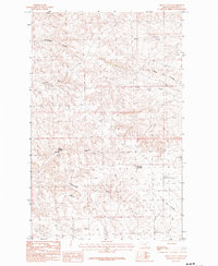
1984 Map of Regal Coulee
USGS Topo · Published 1984About this map
Regal Springs and the surrounding Phillips County landscape are defined by an intricate drainage network of coulees and creeks in this 1984 provisional survey. The terrain is dominated by the seasonal watercourses of Thomas Coulee, Gilbertson Coulee, and the prominent Regal Coulee, which winds through the central portion of the quadrangle. These features, along with names like Dead Horse Coulee and Lost Coulee, suggest a history of ranching and livestock movement through the breaks of north-central Montana.
Find a feature on this map
11 named features on this map. Tap any name to fly to it.
Don’t see what you’re looking for? This feature index may not catch every label — zoom into the map to look around manually.
Map Details
Editions of this 1984 Regal Coulee Map
This is the sole edition of this map. No revisions or reprints were ever made.
Other maps of this area

1905 · Bowdoin
USGS Topo · 1:62,500

1905 · Saco Special
USGS Topo · 1:62,500

1954 · Glasgow
USGS Topo · 1:250,000

1957 · Glasgow
USGS Topo · 1:250,000

1958 · Glasgow
USGS Topo · 1:250,000

1984 · Pinks
USGS Topo · 1:24,000
1984 · Robinson Ranch
USGS Topo · 1:24,000

1984 · Harb
USGS Topo · 1:24,000
1984 · Bowdoin
USGS Topo · 1:24,000
1984 · Saco
USGS Topo · 1:24,000