
1984 Map of Harb
USGS Topo · Published 1984About this map
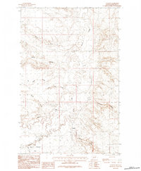
Harb sits within the high plains of north-central Montana, positioned along the border where Phillips Co meets Valley Co. This 1984 provisional survey illustrates a landscape of rhythmic drainage patterns defined by numerous coulees that carve through the dry tableland. These seasonal waterways, including Moss Coulee, Snowbank Coulee, and Pickhandle Coulee, are the primary geographical markers in an area where human settlement is sparse and dictated by the availability of water and the needs of ranching. The presence of Blanche Coulee and Box Elder Coulee to the east further highlights the intricate erosion patterns characteristic of the Missouri River watershed's northern reaches. This document captures the remote character of the Montana plains before later developments, showing the section lines and unimproved roads that provided the only framework for navigation across this expansive territory.
Find a feature on this map
12 named features on this map. Tap any name to fly to it.
Don’t see what you’re looking for? This feature index may not catch every label — zoom into the map to look around manually.
Map Details
Editions of this 1984 Harb Map
This is the sole edition of this map. No revisions or reprints were ever made.
Other maps of this area

1905 · Bowdoin
USGS Topo · 1:62,500

1954 · Glasgow
USGS Topo · 1:250,000

1957 · Glasgow
USGS Topo · 1:250,000

1958 · Glasgow
USGS Topo · 1:250,000

1984 · Pinks
USGS Topo · 1:24,000
1984 · Harb SW
USGS Topo · 1:24,000
1984 · Craig Reservoir
USGS Topo · 1:24,000
1984 · Flat Coulee
USGS Topo · 1:24,000
1984 · Regal Coulee
USGS Topo · 1:24,000
1984 · Content
USGS Topo · 1:24,000