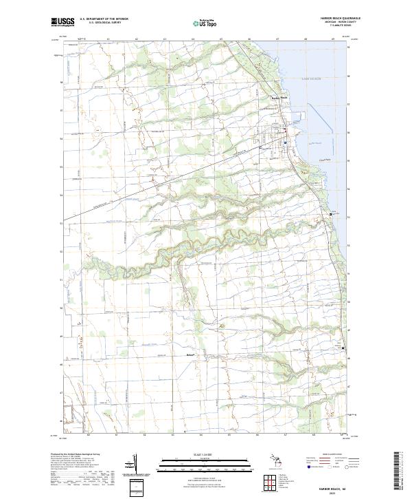
2023 Map of Harbor Beach
USGS Topo · Published 2023About this map
Harbor Beach and its busy Lake Huron waterfront anchor this coastal survey, where the grid of city streets meets the industrial and recreational shoreline of Lake Huron. The landscape is defined by an intricate network of drainage systems and creeks, such as Rock Falls Creek and Spring Creek, which reveal the managed nature of the agricultural hinterland in Huron County. To the south, the smaller settlement of Helena sits along a quiet corridor of farm-to-market roads. Local history and genealogy are well-represented by the inclusion of Rock Falls Cem near the coast and Saint Anthony Cem to the south. These landmarks, along with named points like Crane Point, provide a detailed geographic record of the township and range divisions that have structured this Michigan lakeshore for generations.
Find a feature on this map
63 named features on this map. Tap any name to fly to it.
Don’t see what you’re looking for? This feature index may not catch every label — zoom into the map to look around manually.
Map Details
Editions of this 2023 Harbor Beach Map
This is the sole edition of this map. No revisions or reprints were ever made.
Other maps of this area

1954 · Flint
USGS Topo · 1:250,000

1958 · Flint
USGS Topo · 1:250,000

1963 · Forestville
USGS Topo · 1:24,000

1963 · Ruth
USGS Topo · 1:24,000

1963 · Minden City
USGS Topo · 1:24,000

1970 · Port Hope
USGS Topo · 1:24,000

1970 · Redman
USGS Topo · 1:24,000

1970 · Harbor Beach
USGS Topo · 1:24,000

1970 · Bad Axe SE
USGS Topo · 1:24,000

1984 · Harbor Beach
USGS Topo · 1:100,000