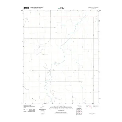
2010 Map of Hardesty SE
USGS Topo · Published 2010About this map
Range serves as the primary focal point of this rural Texas County landscape, located near the winding course of Palo Duro Creek. The area is characterized by a high-plains drainage network, where several significant seasonal watercourses such as Cottonwood Creek, Hackberry Creek, and Sand Draw converge. These features suggest a topography defined by erosion and intermittent water flow, typical of the Oklahoma Panhandle's environmental history. Local genealogy and history are anchored at the Range Cemetery, which overlooks the creek valley. The map also documents the transition from established thoroughfares like Adams Road County Hwy 14 to a rigid section-line grid including Mile 57 Rd and Rd BB, illustrating the structured land division that has governed this region since settlement. Smaller landmarks such as Webb Lake provide localized points of interest within the expansive grazing and agricultural sections.
Find a feature on this map
32 named features on this map. Tap any name to fly to it.
Don’t see what you’re looking for? This feature index may not catch every label — zoom into the map to look around manually.
Map Details
Editions of this 2010 Hardesty SE Map
This is the sole edition of this map. No revisions or reprints were ever made.
Other maps of this area

1954 · Perryton
USGS Topo · 1:250,000

1958 · Perryton
USGS Topo · 1:250,000

1962 · Hansford Camp
USGS Topo · 1:24,000

1968 · Hardesty
USGS Topo · 1:24,000

1968 · Optima Dam
USGS Topo · 1:24,000

1968 · Hardesty SE
USGS Topo · 1:24,000

1968 · Hardesty NE
USGS Topo · 1:24,000

1973 · Horseshoe Hill
USGS Topo · 1:24,000

1973 · Bryans Corner SW
USGS Topo · 1:24,000

1973 · Red Horse Creek
USGS Topo · 1:24,000