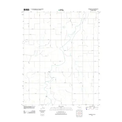
2012 Map of Hardesty SE
USGS Topo · Published 2012About this map
Range and its surrounding agricultural lands in Texas County define this portion of the Oklahoma Panhandle. This landscape is shaped by the intermittent flow of several waterways, including Hackberry Cr, Cottonwood Cr, and Horse Cr, which carve paths through the high plains. The settlement pattern follows a rigid section-line grid of rural roads such as Mile 53 and Co Hwy-14, reflecting the systematic land division of the region. Local history is anchored at the Range Cem, while the presence of Webb Lake and the prominent Sand Draw highlight the subtle variations in terrain and water availability that were critical to early ranching and farming in this arid environment.
Find a feature on this map
34 named features on this map. Tap any name to fly to it.
Don’t see what you’re looking for? This feature index may not catch every label — zoom into the map to look around manually.
Map Details
Editions of this 2012 Hardesty SE Map
This is the sole edition of this map. No revisions or reprints were ever made.
Other maps of this area

1954 · Perryton
USGS Topo · 1:250,000

1958 · Perryton
USGS Topo · 1:250,000

1962 · Hansford Camp
USGS Topo · 1:24,000

1968 · Hardesty
USGS Topo · 1:24,000

1968 · Optima Dam
USGS Topo · 1:24,000

1968 · Hardesty SE
USGS Topo · 1:24,000

1968 · Hardesty NE
USGS Topo · 1:24,000

1973 · Horseshoe Hill
USGS Topo · 1:24,000

1973 · Bryans Corner SW
USGS Topo · 1:24,000

1973 · Red Horse Creek
USGS Topo · 1:24,000