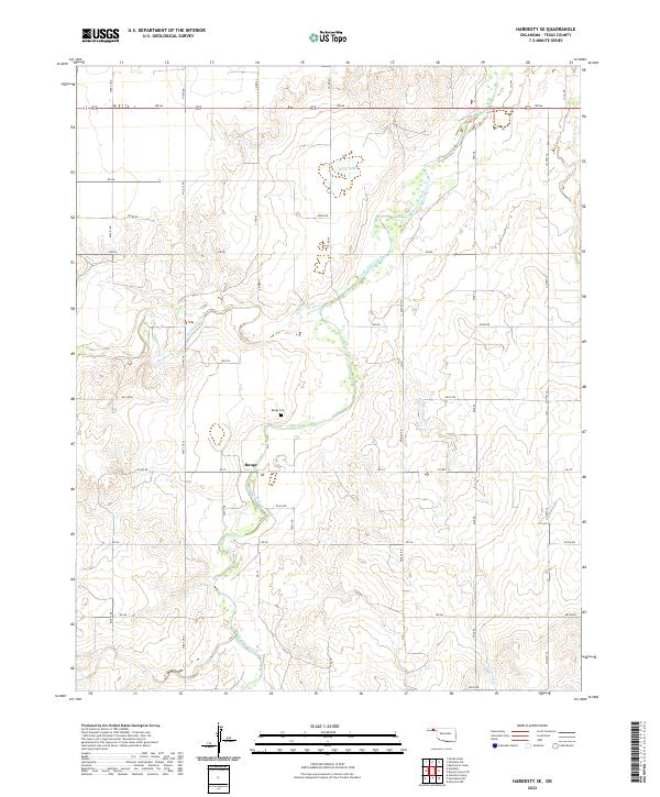
2022 Map of Hardesty SE
USGS Topo · Published 2022About this map
Palo Duro Creek and its many tributaries, including Cottonwood Cr and Hackberry Cr, carve a complex drainage system through the High Plains of Texas County. This modern survey illustrates a landscape primarily defined by section-line roads and agricultural divisions, with the small community of Range serving as a local focal point. Near the center of the sheet, the Range Cem offers a primary point of interest for genealogists tracing early families of the Oklahoma Panhandle.
Find a feature on this map
28 named features on this map. Tap any name to fly to it.
Don’t see what you’re looking for? This feature index may not catch every label — zoom into the map to look around manually.
Map Details
Editions of this 2022 Hardesty SE Map
This is the sole edition of this map. No revisions or reprints were ever made.
Other maps of this area

1954 · Perryton
USGS Topo · 1:250,000

1958 · Perryton
USGS Topo · 1:250,000

1962 · Hansford Camp
USGS Topo · 1:24,000

1968 · Hardesty
USGS Topo · 1:24,000

1968 · Optima Dam
USGS Topo · 1:24,000

1968 · Hardesty SE
USGS Topo · 1:24,000

1968 · Hardesty NE
USGS Topo · 1:24,000

1973 · Horseshoe Hill
USGS Topo · 1:24,000

1973 · Bryans Corner SW
USGS Topo · 1:24,000

1973 · Red Horse Creek
USGS Topo · 1:24,000