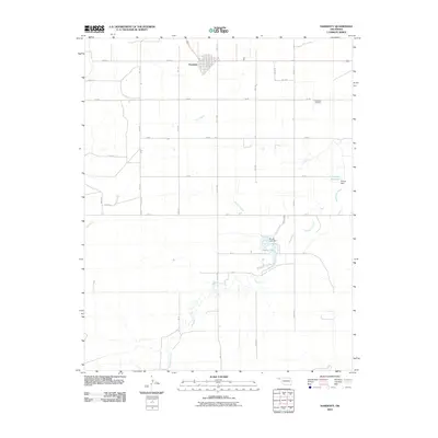
2010 Map of Hardesty
USGS Topo · Published 2010About this map
Hardesty stands as the primary hub of this high plains landscape in Texas County, situated near the intersection of several section-line roads. The town's grid is clearly defined, serving as a focal point for the surrounding ranching and agricultural territory. The terrain is deeply inscribed by the winding course of Hackberry Creek, which meanders across the southern half of the quadrangle, joined by tributaries like Peacher Creek and Dry Creek. These drainages provide the few breaks in the otherwise level topography of the Oklahoma Panhandle.
Find a feature on this map
29 named features on this map. Tap any name to fly to it.
Don’t see what you’re looking for? This feature index may not catch every label — zoom into the map to look around manually.
Map Details
Editions of this 2010 Hardesty Map
This is the sole edition of this map. No revisions or reprints were ever made.
Other maps of this area

1954 · Perryton
USGS Topo · 1:250,000

1958 · Perryton
USGS Topo · 1:250,000

1962 · Hansford Camp
USGS Topo · 1:24,000

1968 · Hardesty
USGS Topo · 1:24,000

1968 · Optima Dam
USGS Topo · 1:24,000

1968 · Hardesty SE
USGS Topo · 1:24,000

1968 · Hardesty NE
USGS Topo · 1:24,000

1968 · Guymon NE
USGS Topo · 1:24,000

1968 · Guymon SE
USGS Topo · 1:24,000

1973 · Horseshoe Hill
USGS Topo · 1:24,000