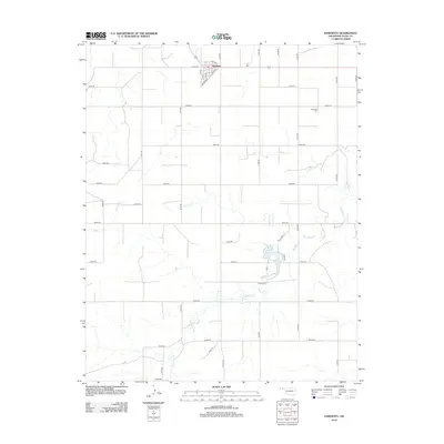
2012 Map of Hardesty
USGS Topo · Published 2012About this map
Hardesty serves as the primary hub of this Texas County landscape, situated where a grid of rural section roads meets the town’s own street plan, featuring Front St and Broadway. The surrounding terrain is defined by the winding paths of intermittent waterways, most notably Hackberry Creek and Dry Creek. These drainages feed into local water features like Shultz Lake and Stinson Reservoir, which provide rare points of surface water in the high plains environment. For those researching local history, the Hartsville Cemetery remains a significant landmark located to the east of the town center. The map's extensive system of numbered county roads, such as E0300 Road and N1030 Road, illustrates the late 20th and early 21st-century agricultural organization of the Oklahoma Panhandle.
Find a feature on this map
40 named features on this map. Tap any name to fly to it.
Don’t see what you’re looking for? This feature index may not catch every label — zoom into the map to look around manually.
Map Details
Editions of this 2012 Hardesty Map
This is the sole edition of this map. No revisions or reprints were ever made.
Other maps of this area

1954 · Perryton
USGS Topo · 1:250,000

1958 · Perryton
USGS Topo · 1:250,000

1962 · Hansford Camp
USGS Topo · 1:24,000

1968 · Hardesty
USGS Topo · 1:24,000

1968 · Optima Dam
USGS Topo · 1:24,000

1968 · Hardesty SE
USGS Topo · 1:24,000

1968 · Hardesty NE
USGS Topo · 1:24,000

1968 · Guymon NE
USGS Topo · 1:24,000

1968 · Guymon SE
USGS Topo · 1:24,000

1973 · Horseshoe Hill
USGS Topo · 1:24,000