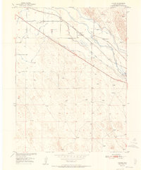
1951 Map of Hardin
USGS Topo · Published 1951About this map
The South Platte River winds through this Weld County landscape, where the mid-century agricultural economy is defined by a complex network of irrigation infrastructure. This 1951 survey reveals the vital role of water management in the region, tracing the Latham Ditch, Riverside Intake Canal, and the Empire Intake Canal as they divert from the river. While some systems were expanding, others were already falling out of use, as seen with the Bijou Canal (Aband) near Bijou Spring.
Find a feature on this map
19 named features on this map. Tap any name to fly to it.
Don’t see what you’re looking for? This feature index may not catch every label — zoom into the map to look around manually.
Map Details
Editions of this 1951 Hardin Map
2 editions found
Other maps of this area

1902 · Greeley
USGS Topo · 1:125,000

1950 · Kersey
USGS Topo · 1:24,000

1950 · Tampa
USGS Topo · 1:24,000

1950 · Barnesville
USGS Topo · 1:24,000

1950 · Klug Ranch
USGS Topo · 1:24,000

1950 · Valley View School
USGS Topo · 1:24,000

1950 · Hardin
USGS Topo · 1:24,000
1951 · Klug Ranch
USGS Topo · 1:24,000

1951 · Hardin
USGS Topo · 1:24,000
1951 · Valley View School
USGS Topo · 1:24,000