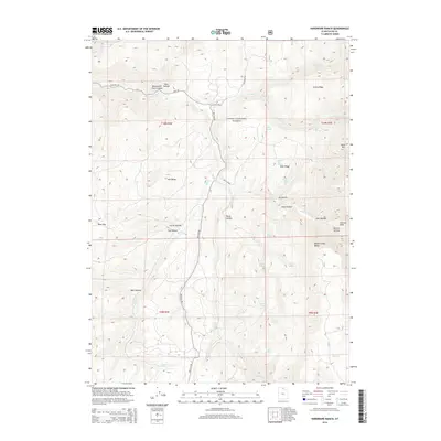
2014 Map of Hardware Ranch
USGS Topo · Published 2014About this map
Hardware Ranch serves as a prominent focal point in this high-altitude section of the Cache National Forest, where the transition from deep canyons to high ridges is meticulously documented. The landscape is defined by the Blacksmith Fork river and its namesake Blacksmith Fork Canyon, carving through the northwestern corner. Moving south and east, the terrain rises into the Monte Cristo Range and Deer Ridge, marked by a network of seasonal springs such as Whiskey Spring and Elbow Spring. The transport network relies heavily on Ant Flat Rd, which tracks through Ant Valley and connects various hollows and draws. This 2014 survey records the modern state of these public lands, showing the naming of features like Gold Hill and Cart Hollow that reflect the area's long history of ranching and resource exploration.
Find a feature on this map
43 named features on this map. Tap any name to fly to it.
Don’t see what you’re looking for? This feature index may not catch every label — zoom into the map to look around manually.
Map Details
Editions of this 2014 Hardware Ranch Map
This is the sole edition of this map. No revisions or reprints were ever made.
Other maps of this area

1912 · Randolph
USGS Topo · 1:125,000

1914 · Logan
USGS Topo · 1:125,000

1916 · Logan
USGS Topo · 1:125,000

1949 · Boulter Mts
USGS Topo · 1:24,000

1954 · Ogden
USGS Topo · 1:250,000

1958 · Ogden
USGS Topo · 1:250,000

1960 · Ogden
USGS Topo · 1:250,000

1964 · Monte Cristo PK
USGS Topo · 1:24,000
1964 · Sharp Mountain
USGS Topo · 1:24,000

1968 · Dairy Ridge
USGS Topo · 1:24,000