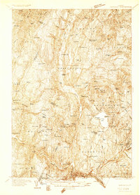
1934 Map of Hardwick
USGS Topo · Published 1934About this map
The Black River and Wild Branch shape the upland terrain of north-central Vermont, where a network of schools and crossroads settlements defined early 20th-century community life. The landscape is punctuated by numerous glacial ponds, including Great Hosmer Pond and Little Hosmer Pond, which sit north of the distinct ridge-top village at Craftsbury Common. To the south, the Lamoille River valley serves as a primary corridor for industry and transit, connecting the mills of Pottersville with the rail line passing through East Hardwick.
Find a feature on this map
98 named features on this map. Tap any name to fly to it.
Don’t see what you’re looking for? This feature index may not catch every label — zoom into the map to look around manually.
Map Details
Editions of this 1934 Hardwick Map
This is the sole edition of this map. No revisions or reprints were ever made.
Other maps of this area
1919 · Lake Memphremagog
USGS Topo · 1:62,500
1919 · Montgomery
USGS Topo · 1:62,500
1919 · Montpelier
USGS Topo · 1:62,500
1920 · Montgomery
USGS Topo · 1:62,500
1920 · Derby
USGS Topo · 1:62,500
1920 · Irasburg
USGS Topo · 1:62,500
1921 · Montpelier
USGS Topo · 1:62,500
1923 · Irasburg
USGS Topo · 1:48,000
1923 · Lake Memphremagog
USGS Topo · 1:48,000
1925 · Irasburg
USGS Topo · 1:62,500