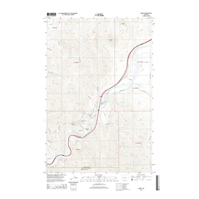
2014 Map of Hardy
USGS Topo · Published 2014About this map
Hardy sits at a strategic bend in the Missouri River, where the canyon walls tighten near DeLacey Point and Chisholm Mtn. This landscape is defined by the river’s passage through several hazardous stretches, including Pine Island Rapids and Lone Pine Rapids, which historically influenced navigation and engineering. The transport corridor along the water is well-documented, showing the path of Old US-91 and the engineering of Tunnel Number 1, reflecting the region's reliance on river-level passes through the mountains of Cascade County.
Find a feature on this map
52 named features on this map. Tap any name to fly to it.
Don’t see what you’re looking for? This feature index may not catch every label — zoom into the map to look around manually.
Map Details
Editions of this 2014 Hardy Map
This is the sole edition of this map. No revisions or reprints were ever made.
Other maps of this area

1886 · Great Falls
USGS Topo · 1:250,000

1949 · Cascade
USGS Topo · 1:62,500

1951 · Cascade
USGS Topo · 1:62,500

1954 · Great Falls
USGS Topo · 1:250,000

1957 · Great Falls
USGS Topo · 1:250,000

1960 · Simms
USGS Topo · 1:62,500

1961 · Craig
USGS Topo · 1:24,000

1961 · Hardy
USGS Topo · 1:24,000

1961 · Hound Creek Reservoir
USGS Topo · 1:24,000

1961 · Rocky Reef
USGS Topo · 1:24,000