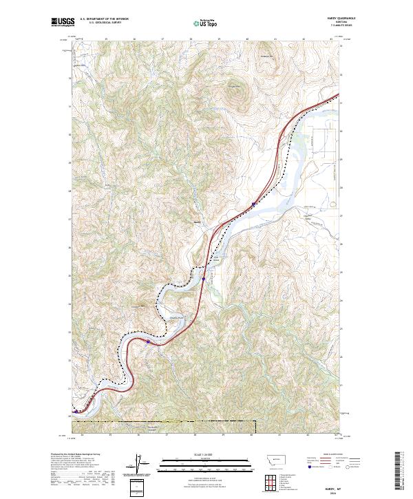
2024 Map of Hardy
USGS Topo · Published 2024About this map
The Missouri River carves a deep, winding path through this portion of Montana, creating a dramatic landscape of sharp bends and named rapids including Pine Island Rapids, Flenikens Rapids, and Brunots Rapids. The settlement of Hardy serves as a central point along Old US Hwy 91, which closely follows the river's eastern bank through the canyon. This 2024 survey captures a terrain defined by high peaks like Antelope Mtn and Chisholm Mtn, contrasting with the agricultural irrigation of the Chestnut Valley Canal in the northern reaches.
Find a feature on this map
52 named features on this map. Tap any name to fly to it.
Don’t see what you’re looking for? This feature index may not catch every label — zoom into the map to look around manually.
Map Details
Editions of this 2024 Hardy Map
This is the sole edition of this map. No revisions or reprints were ever made.
Other maps of this area

1886 · Great Falls
USGS Topo · 1:250,000

1949 · Cascade
USGS Topo · 1:62,500

1951 · Cascade
USGS Topo · 1:62,500

1954 · Great Falls
USGS Topo · 1:250,000

1957 · Great Falls
USGS Topo · 1:250,000

1960 · Simms
USGS Topo · 1:62,500

1961 · Craig
USGS Topo · 1:24,000

1961 · Hardy
USGS Topo · 1:24,000

1961 · Hound Creek Reservoir
USGS Topo · 1:24,000

1961 · Rocky Reef
USGS Topo · 1:24,000