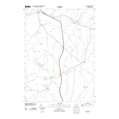
2010 Map of Harford
USGS Topo · Published 2010About this map
Old Mill Village and the rural crossroads of Harford anchor this portrait of Susquehanna County at the start of the 21st century. The landscape is defined by a dense network of glacial lakes and small watercourses, including Nine Partners Creek and Butler Creek, which feed into numerous named bodies like Tingley Lake and Page Lake. This era shows a mix of traditional agriculture and specialized land use, evidenced by the presence of both the Peckins Airport and the Magnetic Laboratories Airport.
Find a feature on this map
51 named features on this map. Tap any name to fly to it.
Don’t see what you’re looking for? This feature index may not catch every label — zoom into the map to look around manually.
Map Details
Editions of this 2010 Harford Map
This is the sole edition of this map. No revisions or reprints were ever made.
Other maps of this area

1892 · Dundaff
USGS Topo · 1:62,500

1932 · Susquehanna
USGS Topo · 1:62,500

1935 · Susquehanna
USGS Topo · 1:62,500

1943 · Montrose
USGS Topo · 1:62,500

1945 · Montrose
USGS Topo · 1:62,500

1946 · Tunkhannock
USGS Topo · 1:62,500
1946 · Clifford
USGS Topo · 1:24,000

1946 · Hop Bottom
USGS Topo · 1:24,000
1946 · Lenoxville
USGS Topo · 1:24,000

1947 · Hopbottom
USGS Topo · 1:24,000