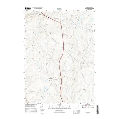
2016 Map of Harford
USGS Topo · Published 2016About this map
Harford serves as the central hub of this Susquehanna County landscape, where the local road network converges near the banks of Tyler Lake. The area's agricultural and rural character is defined by numerous family-named peaks and water bodies, including Jones Hill, Tiffany Hill, and Gillespies Pond. A significant historical landmark is noted at Orphan School Rd, hinting at the civic history of the township.
Find a feature on this map
80 named features on this map. Tap any name to fly to it.
Don’t see what you’re looking for? This feature index may not catch every label — zoom into the map to look around manually.
Map Details
Editions of this 2016 Harford Map
This is the sole edition of this map. No revisions or reprints were ever made.
Other maps of this area

1892 · Dundaff
USGS Topo · 1:62,500

1932 · Susquehanna
USGS Topo · 1:62,500

1935 · Susquehanna
USGS Topo · 1:62,500

1943 · Montrose
USGS Topo · 1:62,500

1945 · Montrose
USGS Topo · 1:62,500

1946 · Tunkhannock
USGS Topo · 1:62,500
1946 · Clifford
USGS Topo · 1:24,000

1946 · Hop Bottom
USGS Topo · 1:24,000
1946 · Lenoxville
USGS Topo · 1:24,000

1947 · Hopbottom
USGS Topo · 1:24,000