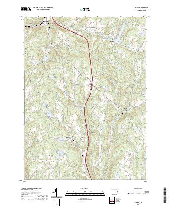
2023 Map of Harford
USGS Topo · Published 2023About this map
The northern Susquehanna County plateau is defined here by the headwaters of Nine Partners Creek and the clustered settlements of Harford and New Milford. The landscape is a complex network of glacial ponds and family-named landmarks, where the valley floors are occupied by water bodies like Tingley Lake and Tyler Lake. This 2023 edition highlights a region that has maintained its rural character while adapting to modern infrastructure, centered around the intersection of historical township hubs and the interstate corridor.
Find a feature on this map
90 named features on this map. Tap any name to fly to it.
Don’t see what you’re looking for? This feature index may not catch every label — zoom into the map to look around manually.
Map Details
Editions of this 2023 Harford Map
This is the sole edition of this map. No revisions or reprints were ever made.
Other maps of this area

1892 · Dundaff
USGS Topo · 1:62,500

1932 · Susquehanna
USGS Topo · 1:62,500

1935 · Susquehanna
USGS Topo · 1:62,500

1943 · Montrose
USGS Topo · 1:62,500

1945 · Montrose
USGS Topo · 1:62,500

1946 · Tunkhannock
USGS Topo · 1:62,500
1946 · Clifford
USGS Topo · 1:24,000

1946 · Hop Bottom
USGS Topo · 1:24,000
1946 · Lenoxville
USGS Topo · 1:24,000

1947 · Hopbottom
USGS Topo · 1:24,000